SOUTHERN UTAH — The National Weather Service in Salt Lake City has issued a “Winter Storm Watch” for the western two-thirds of Utah and southwest Wyoming in effect from late Wednesday through Friday morning.
Affected area
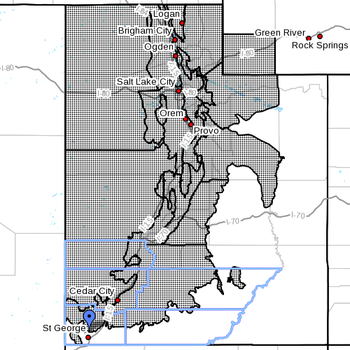
The mountains of Utah, Uinta County in southwest Wyoming and the valleys of western Utah except Dixie. More particularly:
Cache Valley Utah portion, northern Wasatch Front, Salt Lake and Tooele valleys, southern Wasatch Front, Great Salt Lake Desert and mountains, Wasatch Mountain Valleys, Wasatch Mountains I-80 North, Wasatch Mountains South of I-80, western Uinta Mountains, Wasatch Plateau Book Cliffs, Sanpete Sevier Valleys, west central Utah, southwest Utah, central mountains, southern mountains, southwest Wyoming including the cities of Logan, Smithfield, Brigham City, Ogden, Bountiful, Salt Lake City, Tooele, Lehi, Provo, Nephi, Wendover, Snowville, Huntsville, Park City, Heber City, Woodruff, Randolph, Alta, Brighton, Mirror Lake Highway, Scofield, Manti, Richfield, Delta, Fillmore, Beaver, Cedar City, Milford, Cove Fort, Koosharem, Fish Lake, Loa, Panguitch, Bryce Canyon and Evanston.
Snow accumulations
Amounts of 4 to 8 inches in valleys with 12 to 24 inches on mountains by midday Friday.
Timing
Snow will begin late Wednesday night and spread across the area by early Thursday. The snow will continue through Thursday afternoon then turn showery in the evening. Snow showers will persist into Friday over the northern and central mountains as well as the northwest valleys.
Impacts
Accumulating snow will create winter driving conditions across much of Utah and southwestern Wyoming outside of the lower southern and eastern valleys on Christmas Day. This includes all major routes across these areas.
Precautionary preparedness actions
A winter storm watch means there is a potential for significant snow accumulations that may impact travel. Continue to monitor the latest forecasts.
Spotter information
Weather spotters are encouraged to report significant weather conditions according to standard operating procedures.
For more information visit the National Weather Service website or for information regarding potential road travel impacts visit the Utah Department of Transportation website.
Related posts
- Fire Chief gives reminders for holiday fire safety, tips for tree disposal
- Schnapps anyone? Red Cross busts winter-safety myths
- Stocking your vehicle for winter; what to do in case of emergency, checklist
Email: [email protected]
Twitter: @STGnews
Copyright St. George News, SaintGeorgeUtah.com LLC, 2014, all rights reserved.
Well let’s hope there is no tragic news awaiting anyone. Let’s hope that all the people traveling make it to their destination to be with friends and family upon this most joyous holiday. Happy Holidays everyone
Locals never have to think about this stuff but….Cal Ranch, the larger Walmart stores and most car parts stores sell chains. They’ll be open tonight and part of tomorrow. It’s a good time to give yourself the gift of safety….chains, blankets, flashlights…before it starts snowing.