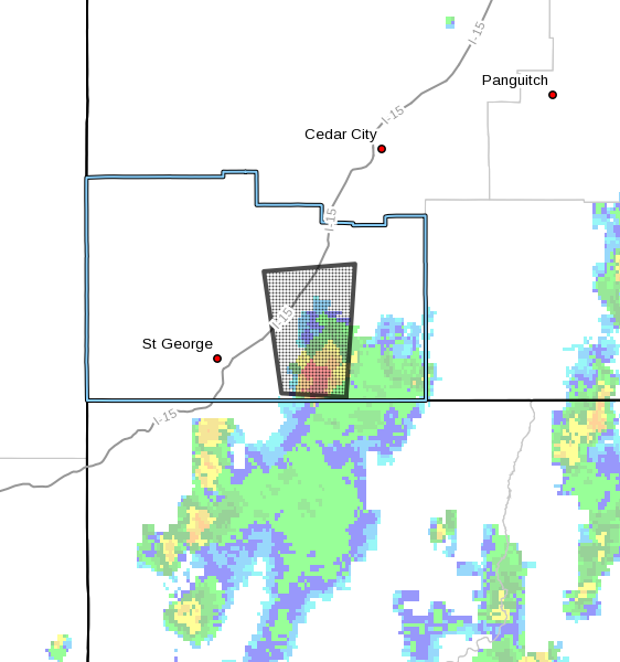
ST. GEORGE — A significant weather advisory has been issued for southeastern Washington County. This advisory is in effect until 4 p.m. Saturday.
At 3:14 p.m. the National Weather Service Doppler radar indicated a strong thunderstorm near Hurricane, 17 miles east of St. George, moving north at 25 mph.
Impacts
Hail 1/2 inch in diameter and wind speeds in excess of 40 mph will be possible, along with heavy rainfall.
Impact area
Hurricane, LaVerkin, Toquerville, Leeds, Virgin and Pintura are expected to be impacted by this storm system.
Precautionary/preparedness actions
If threatening weather approaches, take shelter in a sturdy building. This storm is capable of producing a significant amount of hail. Hail may accumulate on area roads, resulting in dangerous travel conditions.
Email: [email protected]
Twitter: @STGnews
Copyright St. George News, SaintGeorgeUtah.com LLC, 2016, all rights reserved.