Updated Sunday, 3:20 p.m. – Red flag warning extended to midnight Tuesday in some areas. See Impacts section for additional particulars. Current radar maps substituted into report.
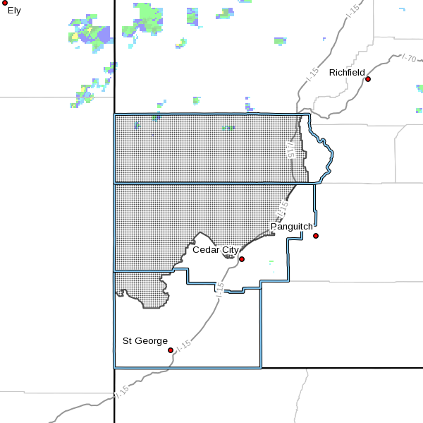
ST. GEORGE — Strong winds and low humidity forecast for the coming days give rise to a red flag warning indicating fire risks for the central Utah mountains and central Utah’s west desert regions, including parts of Washington County. The warning, issued by the National Weather Service, will be in effect from noon Sunday until midnight Tuesday.
A red flag warning means that critical fire weather conditions are occurring or will occur shortly. The combination of strong winds and low humidity can contribute to extreme fire behavior.
Affected area
The affected areas for this red flag warning are the northern Mojave desert, the western Uintah basin, the southern Ashley National Forest, the Tavaputs plateau, the San Rafael swell and the central Utah west desert.
Impacts
Southwest winds with gusts up to 40 mph will be possible with extremely low humidity of 10 to 15 percent. This will create the potential for rapid fire growth.
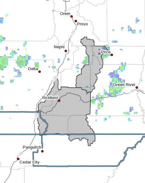
Update: Widely scattered dry thunderstorms are expected to develop Sunday, according to a midday Sunday notice issued by the Weather Service for areas of the Manti National Forest, central Utah mountains and Color Countrt West Desert. These dry thunderstorms may enhance the winds nearby with gusts exceeding 40 mph.
Read more: Risky fire weather forecast extends to Southern Nevada
Precautionary – preparedness actions
The following fire safety tips, previously published by St. George News in 2013, were offered by Washington County Emergency Services for fire prevention:
- Make sure you can legally burn in your area. Check with local authorities and obtain a permit
- Check the weather before you light a fire. High winds, high temperatures and low humidity radically intensify fire
- Choose a safe burning site away from trees or bushes, buildings or other flammable fuels
- Have means, like water or an extinguisher, to douse your fire quickly
- Stay with your fire. Don’t leave it unattended
- Don’t burn garbage, waste, construction debris, plastic, foam, rubber or other offensive substances
- Don’t throw lighted material, including cigarettes, from vehicles
- Use fireworks with caution, obey fireworks laws and don’t use illegal fireworks
- Always extinguish the fire completely before you leave it
- Never park on, or drive through, dry grass
- Be careful with the use of heat or spark generating tools or ATVs
- If you live in a wildland interface area, be prepared for wildfire
- Provide for defensible space around your home and out buildings
- Have a wildfire action plan for your family
- Have your important documents and disaster kits ready to go in an emergency
- Leave early if a fire threatens your neighborhood
Email: [email protected]
Twitter: @STGnews