ST. GEORGE — A number of crash stories involving cars hydroplaning on Interstate 15 near mile marker 36 in Washington County has fueled an influx of reader-submitted comments about this particular stretch of road, prompting St. George News to investigate the issue further.
One such comment posted on Facebook Feb. 14 alerted drivers traveling in either direction that I-15 “is like a river going down the Black Ridge. South side is really bad and cars are starting to back up.”
Similar comments have been posted after a story involving crashes during heavy rains on I-15 was published. One report in particular involved vehicles hydroplaning near mile marker 32 and 36 on the northbound side and on the southbound side at mile marker 36.
I-15 is Utah’s longest, most-traveled highway and serves as the state’s primary artery, traveling directly through the heart of the most populated counties in Utah.
Accordingly, the Utah Department of Transportation develops a long-range transportation plan that outlines numerous road projects to accommodate for future traffic needs and to enhance roadway safety.
One such expansion project that began last summer on I-15 at about milepost 28 and continued through to Exit 40 involved widening and improving the infrastructure of that corridor by adding a northbound climbing lane. This enhancement would not only ease the volume of overall traffic by providing an additional lane of travel but would also relieve the bottleneck that often occurs with slower-moving vehicles traveling on a steep uphill grade.

Since then, it appears there has been an increase in the number of vehicles reportedly hydroplaning, particularly during heavier-than-normal rainfall.
“This isn’t the first we’ve heard about this issue,” UDOT spokesman Kevin Kitchen said.
Several components involved with managing rainwater were addressed during the expansion, Kitchen explained, including a number of safety improvements, such as pavement rehabilitation, micro-surfacing and the widening of several large culverts.
However, two components of the project have led to an increased possibility of hydroplaning: increased surface area and road paving materials.
Adding a lane naturally expanded the road surface area, and one of the consequences of that expansion is that a wider area means an increase in the amount of rainwater that now has more area to run across.
The new lane resulted in a road-surface increase of nearly 30 percent, minus the width of the shoulder areas, Kitchen said, which can result in more rainwater sheeting across the roadway.
“We have a larger surface area, so the water has more distance to cover before it reaches the edge and runs off the roadway,” he said.
To reduce the accumulation of rainwater on the road surface, Kitchen said the project included constructing catch basins designed to collect the rainwater that typically runs down the slopes adjacent to the highway to prevent it from running across the roadway.
The water collected in the catch basins then flows through new, larger culverts placed underneath the road and is diverted away from the highway to reduce the amount of water sheeting across the road.

The culverts also reduce the amount of water collecting in the soil that serves as the foundation for the highway. The water could otherwise undermine the structural integrity of the road and cause erosion-related damage.
As to claims of water flowing across the interstate, Kitchen responded by saying the road is designed to create a sheeting effect as water moves across the asphalt.
“It is doing what it is designed to do,” he said.
Even so, Kitchen added that while the drainage system is collecting the water where it can, “what we’ve seen in heavier rain is that some of the water runs over the barriers up there near 36, which is something we are looking at.”
The situation has been exacerbated by the volume of water delivered during a number of recent rainstorms, he said, which has been significantly higher and is anything but typical.
New K-rails — concrete barriers — were also added during construction, he said, which prevents the water running down nearby hillsides or alongside the interstate from entering and potentially collecting on the roadway.
Those barriers have prevented the runoff where they were placed, Kitchen said, which may have resulted in that same water flowing farther down where it ends up accessing the interstate from a different point.
“The expansion created a big change, so we are looking at it closely to see if water is accessing the road from a new location created when the barriers blocked access in the troubled spots during construction,” Kitchen explained.
Another contributing factor involves the way in which asphalt is manufactured. Because it’s a petroleum-based material, it secretes oil for several months after construction and then begins to taper down.
When rain mixes with oil from motor vehicles and oil secreted by the newly laid asphalt, the result is a slippery roadway. During particularly heavy rainfall, Kitchen said those conditions worsen as water moves across the oily surface, increasing the risk of hydroplaning significantly.
Kitchen said UDOT’s engineers are taking a closer look at the amount of water accessing the road surface and the manner in which it is sheeting or pooling to determine if more can be done to lessen the risk of hydroplaning and optimize road safety.
“Safety is huge, huge, huge to us,” Kitchen said.
UDOT maintains nearly 16,000 lane-miles of state highway across Utah and develops a long-range transportation plan every 4 years to summarize anticipated transportation system needs for the next 25-30 years. It costs more than $250 million annually to preserve the $20 billion in asphalt lining the state’s highways, according to UDOT’s “2015-2040 Long Range Transportation Plan Report.”
A matter of responsible driving
Besides road design, increasing road safety also involves motorists adapting driving behaviors to meet the weather and road conditions present at the time.

A common theme in the majority of St. George News’ I-15 crash reports involving poor weather is that drivers were going too fast for conditions.
In a rain-related crash report published earlier this month, Utah Highway Patrol Sgt. Jake Hicks repeated a sentiment that he and many other troopers have conveyed before:
This is all due to weather conditions and people driving too fast, and they’ve got to slow down. The faster a vehicle is going, the more likely it is to hydroplane. That’s just how it works.
Hydroplaning 101
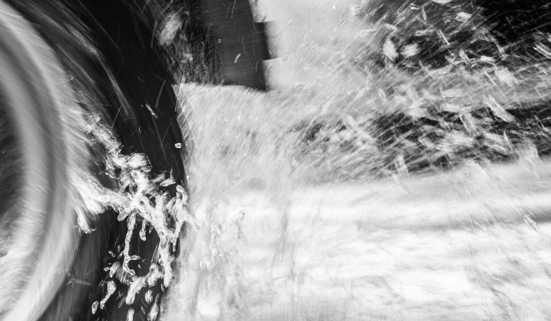
Hydroplaning results from tires moving quickly across a wet surface. At high speeds, a tire does not have sufficient time to channel moisture away from the center of the tire as it’s lifted away from the road by the water, which causes it to lose all traction.
When entering a puddle, the surface of the tire must move the water out of the way in order for the tire to stay in contact with the pavement. The tire compresses some of the water to the sides and forces the remaining water through the tire treads.
On a smooth, polished road in moderate rain at 60 mph, each tire has to displace about a gallon of water every second from beneath a contact patch no bigger than a size-9 shoe. Moreover, the bulk of the water must be displaced for the tire to press through the remaining thin film and then grip the road surface in the 1/150th of a second that each tread is on the ground.
Email: [email protected]
Twitter: @STGnews
Copyright St. George News, SaintGeorgeUtah.com LLC, 2019, all rights reserved.